Cruise Destination Maps
Maps for USA Ports of Call


Venice
Get to know our slice of Paradise - located on the SW Coast of Fl.
Attractions
Beaches
Canoe/Kayak
Boat Launches
Boat Charters
Fishing Charter
Fishing Piers
Historical Sites
Golf
Parks
Hotels
Relocate
Venice Map
Maps of the USA
ports > maps > USA
USA Destinations
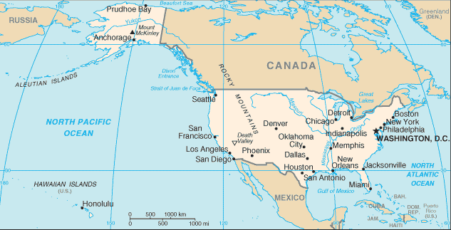
The Unites States is a federal union of fifty states. The country is situated mostly in central North America, where its forty-eight contiguous states and Washington, D.C., the capital district, lie between the Pacific and Atlantic Oceans, bordered by Canada to the north and Mexico to the south.
The state of Alaska is in the northwest of the continent, with Canada to the east and Russia to the west, across the Bering Strait. The state of Hawaii is an archipelago in the mid-Pacific. The country also possesses several territories in the Pacific and Caribbean.
States with cruise ship ports include:
|
Alabama Alaska California Florida Hawaii Louisiana Maryland Maine |
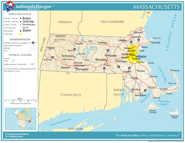
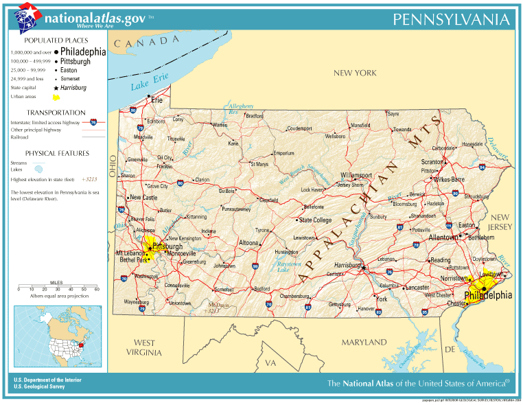
Massachusetts New York NJ Port Authority NY/NJ Ferry Map Pennsylvania South Carolina Texas Washington |
PDF Maps
Miami
Coconut Grove
Downtown Miami
Miami Beach
South Beach
Miami - Dade Co
South Miami- Dade Co
Charleston SC
Charleston Peninsula Map
Greater Charleston Map
North Charleston Map
Convention Center/Tanger
Check the individual port pages for the best selection of maps and links


